- | 9:00 am
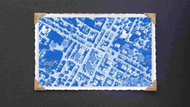
Who really runs MENA’s largest cities? Smart maps
As traffic worsens and infrastructure lags, navigation apps are transforming the daily commute.


In cities like Riyadh, Dubai, and Cairo, the daily commute has long been a gruelling test of endurance. Between population growth, expanding suburbs, and car-centric planning, a simple drive can feel like a slow crawl through organized chaos.
In Dubai, motorists lose an average of 45 hours a year in traffic, according to the Inrix 2025 Global Traffic Report, highlighting the cost of congestion in highly connected cities. Riyadh and Cairo face similar strains as their populations and city boundaries expand.
As traffic worsens and infrastructure lags, navigation apps are transforming the daily commute. They predict congestion, rerouting millions of journeys, and quietly reshape how people move across the region.
TURNING CHAOS INTO PREDICTION
According to MapMetrics, real-time data has become the backbone of modern navigation. The platform notes that live information collected from GPS sensors, smartphones, and connected vehicles allows algorithms to “adjust routes dynamically, reflecting immediate changes in traffic, weather, or accidents.” Unlike traditional static maps, which rely on fixed data sets, modern navigation engines analyze “continuous streams of user-generated information,” enabling them to predict and adapt to changing conditions almost instantly.
In cities like Dubai or Riyadh, this means navigation apps can forecast congestion patterns not only from current conditions but also from recurring patterns, such as school hours, prayer times, and weekend events.
“Navigation apps use the GPS receiver board of commuters’ cell phones to get data on road traffic. This data is combined with input from connected vehicles, city-owned sensors, and cameras. This data gets fed to traffic planners to predict congestion on city roads throughout the day,” says Dr. Mamoun Abdel-Hafez, Head of the Department of Mechanical Engineering at the American University of Sharjah.
However, he adds, most of this data does not accurately predict over long time periods, as traffic can change quickly, rendering the predictions erroneous. “Therefore, AI engines incorporate patterns of historic data—such as weekend congestion, major events, or adverse weather—learning from these scenarios over the years.”
What emerges is predictive mobility, where the algorithm not only guides but anticipates. The result is smoother commutes, reduced idling, and, in some cases, improved air quality as engines spend less time running in gridlock.
THE NEW PSYCHOLOGY OF COMMUTING
Dr. Mamoun points out that predictive navigation has altered commuter behavior. “You rarely find commuters who still depend on their memory to find their route,” he says. “This trained human neural instinct is now moved to the computerized neural network and AI algorithms. This is in effect reducing the stress on drivers to make sure that they select the correct route to their target location.”
Today’s drivers trust the algorithm to know better — when to leave, where to turn, and how to adjust mid-journey. That shift has redefined urban time management. In a city like Dubai, a meeting across town is no longer a logistical gamble but a data-driven calculation.
The behavioral impact extends beyond commuting. In both Dubai and Riyadh, property developers now highlight drive times in listings, often specifying routes and durations at peak hours. Statistics show that customers are using navigation apps to make decisions about where to rent or buy their property. You now find a lot of shopping and leisure centers away from city centers,” says Dr. Mamoun.
He adds that opening these centers near neighborhoods proves people care about travel time to work or shopping. “In Dubai and Riyadh, property listings now often include key metrics like ‘22-minute drive to Downtown via Sheikh Zayed Road (at 8 AM)’. It’s a value derived directly from navigation app data. Proximity to major highways with reliable travel times is a premium.”
DATA BEHIND THE DRIVE
Behind these predictive maps lies a constant stream of location data that cities are beginning to use for planning. Once names and personal details are removed, everyday trips start to show where cities really slow down, speed up, or break.
In Dubai, for instance, the Roads and Transport Authority uses mobility data to model the impact of new tunnels or interchanges on travel times before construction begins. In Riyadh, transportation planners analyze traffic flow to identify recurring choke points and redesign problematic intersections. Cairo’s urban authorities are leveraging similar data to trace the root causes of chronic congestion—whether it’s a misaligned signal, a poorly designed merge point, or a street layout that funnels too much traffic through residential areas.
As MapMetrics highlights, “the integration of real-time data not only enhances user experience but also promotes safer, more efficient journeys.” The continuous stream of mobility information allows both public agencies and private firms to simulate and forecast traffic evolution, test infrastructure strategies, and even evaluate the environmental impact of potential changes before breaking ground.
For logistics companies, predictive intelligence optimizes fleet movement and operations. Delivery vehicles can now avoid current and future congestion, dynamically rerouting to achieve faster deliveries, lower fuel consumption, and reduced costs.
WHEN OPTIMIZATION OVERLOADS
But these shortcuts can create new problems. Navigation apps sometimes send hundreds of drivers through quiet residential streets, turning them into unexpected traffic routes. “Predictive routing can reroute many drivers to the same path. However, this is usually quickly avoided when the navigation app sees a less congested route and starts to divert vehicles to it,” says Dr. Mamoun.
He says the problem with navigation apps is that they cannot predict traffic accidents that make sudden changes to road traffic. “Apps can therefore simultaneously divert hundreds of cars into quiet residential streets not designed for through-traffic, causing safety hazards to residents and localized congestion.”
Authorities across the Gulf are beginning to address this through software-based zoning controls and better coordination with map providers, ensuring that the algorithms behind convenience don’t compromise livability. As AI models grow more nuanced, they’re learning to factor in these human and urban sensitivities—balancing efficiency with equity in road use.
THE ROAD TO AUTONOMOUS AND ELECTRIC MOBILITY
The same predictive systems underpinning navigation apps are now paving the way for a smarter mobility future. Autonomous vehicles rely on navigation for guidance, control, and decision-making,
“The autonomous vehicle providers, with the UAE’s vision for 2030, 25 percent autonomous transport, need all the help from AI tools to do the navigation, guidance, and control algorithms to enable the different levels of autonomous driving,” says Dr. Mamoun.
Adding to that perspective, Oliver Kallenborn, Senior Director of Data and Technology Solutions at AtkinsRéalis, says the integration of data, AI, and mobility intelligence is redefining how cities operate.
“Cities are evolving at an unprecedented pace. Every route suggested on platforms like Google Maps or Waze relies on a sophisticated ecosystem of AI, satellite technology, and real-time data from millions of users. This is more than avoiding traffic; it equips city planners to anticipate congestion, optimize emergency response, and manage infrastructure dynamically,” he says.
Kallenborn adds that in the Middle East, where urban growth and mobility demands are accelerating, these insights are essential. “Integrating digital platforms into urban masterplanning is no longer optional. It is the foundation for building resilient, sustainable, and economically competitive cities.”
He points out that the convergence of AI, data, and infrastructure planning is key to the region’s decarbonization goals.
“We see the convergence of AI, data, and urban planning as a powerful catalyst for achieving Net Zero goals,” Kallenborn says. “The infrastructure, mobility systems, and data strategies we design today will shape the livability, adaptability, and global competitiveness of our cities for decades to come.”
Across the region, smart mobility strategies are evolving to merge navigation intelligence with electric and public transport networks. Real-time updates in apps like Yango Maps integrate bus, metro, and ferry positions, helping commuters plan multimodal trips. Predictive models could soon link EV routes to charging availability, steering drivers toward stations with lower predicted demand or suggesting energy-efficient routes that minimize battery drain.
This convergence points toward a future where navigation systems become the central nervous system of city mobility — unifying private vehicles, public transit, and smart infrastructure into a single, responsive ecosystem.
THE DATA DILEMMA
However, as these systems become increasingly intelligent, the issue of privacy becomes more pressing. “The privacy of users is being compromised as they agree to share their location and movement data,” says Dr. Mamoun. Reputable apps now offer granular privacy controls, including options to limit data sharing to “only while using the app,” turn off location history, or utilize privacy-focused modes; however, awareness of these features remains low.
As cities push for smarter ways to move people around, there’s a fine balance between convenience and control. The bigger shift isn’t just in how we get around, it’s in what we give up every time we move. Maps now quietly shape how we move — and think.