- | 9:00 am
The most powerful economic indicator in the world is orbiting above you
The most powerful real-time economic indicator in the world has been orbiting the Earth this whole time


Nobody watching the first Landsat satellite launch in 1972 was thinking about hedge funds. The mission was geological mapping, environmental monitoring, and the patient work of reading the Earth from above.
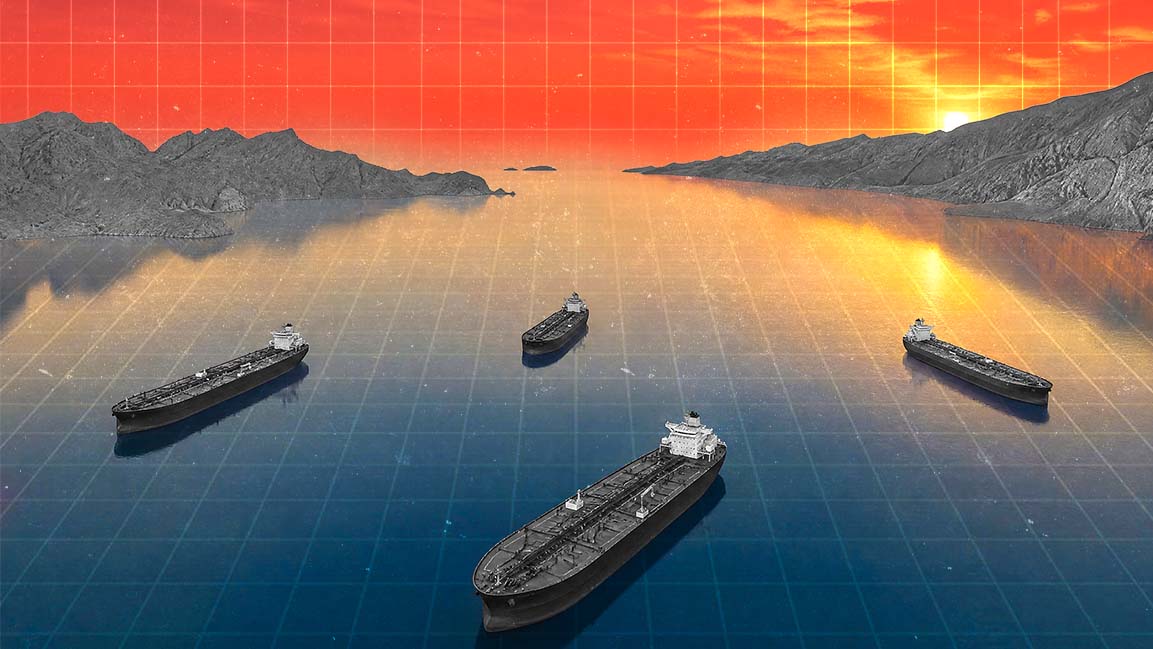
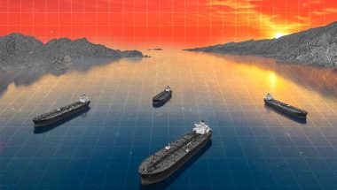
Half a century later, the most commercially valuable thing about orbital imagery turns out to be what it can tell a trading desk about supertankers moving through the Strait of Hormuz, oil storage levels at Fujairah, or container throughput at Jebel Ali. Satellite data has become, of all things, a real-time economic indicator, and the analysts extracting alpha from overhead photography are less interested in the planet’s surface than in what it is doing to commodity prices.
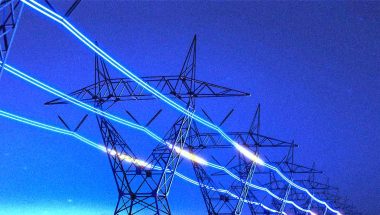
Geospatial intelligence, once the domain of intelligence agencies and defense contractors, has become one of the more unlikely edges in financial markets. The ability to count vessels, estimate crude inventory from rooftop geometry, and track port congestion from orbit is now a legitimate line item in a trading desk’s data budget, and it routinely beats the elaborate forecasting models economists spent decades building.
A camera pointed at an oil tank is both faster and less susceptible to revision than anything a statistics bureau publishes. But as the technology matures and the data become more precise, the story of how satellite imagery leaped from a niche instrument to a real-time economic indicator begins, improbably, in orbit.
THE ORBIT ECONOMY
What transformed satellite data from a niche capability into a real-time indicator of economic activity was not any single breakthrough. It came from several forces arriving at once. “Larger satellite constellations have expanded global coverage,” says Hasan Al Hosani, CEO of Smart Solutions at Space42. “More frequent revisit rates have enabled near real-time monitoring of assets and events. And advances in AI and geospatial analytics have made it possible to process vast volumes of imagery and extract timely intelligence.”
Across industries, he notes, physical movement leaves measurable signals that can be observed from space and translated into valuable insights, making activity visible at scale across port congestion, shipping volumes, infrastructure development, and industrial operations.
Antoine Halff, co-founder of Kayrros, frames the same shift through the lens of supply and demand. On the demand side, conventional statistical sources have proved increasingly inadequate in keeping pace with a rapidly changing global economy.
On the supply side, the proliferation of unconventional data from multiple sources, including satellites, has converged with breakthroughs in machine learning, rapid growth in computing power, and steep declines in data storage costs. Today, even government agencies rely partly on private-sector services to fulfill their mandate of providing economic transparency.
These advances have fundamentally changed how economic intelligence is gathered. Markets once relied on customs filings, company disclosures, and government statistics, all of which arrived with delays of days to months. By contrast, satellite imagery can reveal activity at ports, energy infrastructure, and shipping lanes in near real time, often before it appears in official datasets. “Now, satellite imagery can show what is physically happening on the water, at ports, and around energy infrastructure before any of it appears in official datasets,” says Claire Jungman, Director of Maritime Risk and Intelligence at Vortexa.
The clearest demonstration of this shift came in February 2022, when Russia invaded Ukraine. While traditional trade data took weeks to reflect the rerouting of Russian crude exports, satellite imagery combined with AIS tracking and cargo intelligence made those changes visible almost immediately.
That speed advantage is now embedded in the way commodity markets and logistics operators function. Peter Platzer, Executive Chairman and founder of Spire Global, says the company’s technology can track vessels worldwide at frequent intervals, providing traders and energy market participants with more timely visibility into global shipping movements.
Robbie Schingler, Co-Founder and Chief Strategy Officer of Planet Labs PBC, frames the shift in starker terms. Just as Google indexed the internet to make it searchable, he argues, Planet is doing the same for the physical Earth, moving from periodic snapshots to a continuous understanding of how the physical economy operates. The goal, as he puts it, is to become the auditor of the $100 trillion global economy by providing ground truth.
Jasper Verschuur, Assistant Professor in Engineering Systems & Climate Security at Delft University of Technology and a Research Associate at the Environmental Change Institute at the University of Oxford, whose research has examined satellite-derived proxies for trade activity, points to cloud computing as the force multiplier that made all of this accessible at scale, lowering barriers to data access alongside the growth in satellites themselves.
The economic signals now being read from space span vessel movements, port activity, construction progress, crop health, logistics flows, and night-time lights.
Sultan Al Zeidi, Senior Engineer for Space Projects Development at the UAE Space Agency, describes how this has elevated satellite data to what he calls “a measurable input into economic forecasting, resilience planning, investment decisions, and national competitiveness.”
For the UAE specifically, the implications have moved into the architecture of national decision-making. The country has built an AI-enabled geospatial ecosystem through the UAE Space Data Center and GIQ platform, connecting more than 300 Earth observation satellites, 47 AI models, over 13 local and international partnerships, and more than 30 operational use cases. “The strategic value lies in reducing the time between observation, analysis, and action,” Al Zeidi says, “enabling faster and more informed decision-making across vital sectors.”
READING BETWEEN THE WAVES
What investors and analysts are extracting from satellite imagery is, at its core, anticipatory intelligence. Platzer draws on his own background trading commodities on Wall Street to make the point directly. The extraordinary value lies in knowing when demand will rise or supply will shrink before that information reaches the wider market.
The signals being tracked operate at multiple levels. Al Zeidi cautions that it is more accurate to speak of activity indicators rather than direct financial indicators. Satellite data can detect vessel presence, changes in port and coastal activity, land-use change, construction progress, storage-area utilization, infrastructure expansion, environmental risks, and activity around strategic assets.
When combined with AI models and complementary datasets, these indicators can support early understanding of supply-chain movements, energy activity, logistics pressures, and infrastructure utilization. The value, he argues, lies not in the image itself but in the ability to convert imagery into reliable time-series indicators that reveal trends, anomalies, and operational changes over time.
At the vessel level, analysts assess whether a tanker is laden or in ballast, at berth or drifting, conducting a ship-to-ship transfer, or showing AIS behavior that does not match its physical location. At the port and infrastructure levels, they assess whether vessel queues are building, terminal activity is slowing, or tank levels are rising or falling.
A striking illustration came during the 2020 oil price crash, when analysts watched crude accumulate in supertankers off Singapore and the UAE in near real time, weeks before official inventory data confirmed the glut. But the image alone is not the insight. The market-relevant question is always what cargo is onboard, where it is loaded, where it is heading, and what that means for supply balances or freight rates.
Halff extends that logic into the broader architecture of market intelligence. Inventory data are widely considered the best real-time indicator of supply and demand balances, with tanker traffic data providing additional transparency.
Cross-referencing stock and shipping data yields further insights into industrial activity and previously opaque areas of the market, including end-user consumption and secondary and tertiary storage.
In times of crisis, which Halff notes have lately been the norm, investors turn to satellite data to assess real-world impacts and ground-truth their assumptions and model accuracy.
Since the start of the Middle East conflict, oil inventory data have been in exceptionally high demand to assess the status and prospects of regional supply and forecast the runway to tank tops in the Gulf and tank bottoms elsewhere.
Verschuur offers a more granular perspective on how analysts actually use this information, noting that they are typically tracking relative changes, which they combine with their own knowledge of specific assets and systems to make inferences.
Al Zeidi argues that the focus is increasingly shifting from collecting imagery to extracting actionable intelligence, where the measure of value is not what is seen but what is done with it.
THE DATA GAP
Satellite data is valuable, but it is not a standalone proxy for economic performance. Jungman describes it as an early, physical indicator, more immediate and harder to obscure than official data, but one that still requires interpretation. A vessel at anchor could mean congestion, weather delays, or simply waiting for orders, and context determines which.
That context is precisely what traditional indicators struggle to provide in time. Government statistics are released months after the fact, says Platzer, and some countries are notoriously unreliable in releasing accurate data, particularly when the numbers might not fit the prevailing narrative.
Space-based data and analytics, by contrast, are released continuously and grounded in observable facts rather than reported figures. Al Zeidi draws a similar distinction, noting that traditional indicators often explain what has already happened, whereas satellite data helps decision-makers understand what is happening in real time, detecting physical changes before monthly trade statistics, quarterly GDP figures, or official reports are published.
Halff is more categorical, arguing that when properly analyzed and interpreted, particularly when based on data fusion combining inputs from multiple satellites, geospatial data provides the most timely, granular, comprehensive, and accurate picture of the economy available today.
High-frequency data is especially valuable, offering a dynamic, near-continuous view of trends and patterns over time rather than one-off snapshots at discrete points.
That said, trade data and government statistics still serve a purpose, if only to validate the accuracy of geospatial data after the fact. Not all satellite data is equal: the quality of sensors matters, but the quality of image processing matters even more. Major breakthroughs in processing and analyzing imagery at scale have expanded what can be extracted from existing instruments. However, this has historically required humans in the loop, including data scientists, optical physicists, and subject-matter experts committed to methodological consistency. With multimodal foundation models trained on geospatial data now on the horizon, the industry may be approaching breakthroughs in transparency, forecasting capacity, and understanding.
Verschuur urges a more measured view. Shipping data is a useful indicator for maritime trade volume, but it does not capture all trade, and it is difficult to know precisely what products are being imported or exported. Storage levels at ports or warehouses can proxy for oil markets or the retail sector, but they are not a substitute for official data. Combined, however, these sources can say something meaningful about the economy overall.
Schingler points to AI as the force resolving one of the sector’s most persistent adoption problems. Historically, extracting value from satellite data required deep geospatial expertise and the ability to manage enormous file sizes. AI is already bridging both challenges, he says, compressing and simplifying datasets so that insights are increasingly accessible to users who shouldn’t need a PhD in remote sensing to get them.
Satellite data is most powerful alongside traditional economic indicators, not instead of them. Trade statistics and industry reports provide established measures of market performance; satellite data provides a direct, continuous view of on-the-ground activity. The strongest signal comes from layering – combining satellite imagery with AIS, cargo movements, port calls, freight flows, and analyst validation. No single dataset tells the full story.
THE INDEPENDENT VIEW
In markets where official data is delayed, incomplete, or deliberately obscured, satellite intelligence offers something traditional reporting cannot: an independent, on-the-ground view of what is actually happening.
Platzer distills the advantages as timeliness, completeness, accuracy, and transparency, and Halff extends that argument, contending that these qualities do not simply make for stronger analysis but ultimately support a more efficient, flexible, and resilient economy.
Nowhere is that more consequential than in markets involving sanctioned or opaque crude flows. Jungman describes how vessels carrying Iranian, Russian, or Venezuelan crude routinely turn off AIS transponders, spoof their locations, or conduct ship-to-ship transfers in international waters. After Russia’s 2022 invasion of Ukraine, this became standard practice with ESPO and Urals cargoes. In those circumstances, satellite imagery is often the only way to validate what is actually happening. Markets frequently move before official data catches up, and that early read on export slowdowns, rerouting, or supply disruption is where the real analytical edge lies.
Al Zeidi situates that edge within a broader set of applications. Satellite intelligence provides independent, consistent, and cross-border visibility, particularly valuable when official data is fragmented or limited. It supports early detection of supply-chain disruptions, agricultural stress, infrastructure bottlenecks, environmental risks, and disaster impacts.
For governments, these capabilities strengthen food security, climate resilience, emergency response, and infrastructure planning. Al Zeidi sees this reflected in national geospatial platforms, where satellite-derived insights are increasingly integrated into decision-support systems rather than used solely for observation.
Verschuur argues that proxies need to be validated and calibrated against official data to correct for biases. Al Hosani frames the same principle as closing information gaps, helping organizations monitor change, allocate resources, and make informed decisions across infrastructure, logistics, and investment.
DESKS, DATA, DECISIONS
Trading desks and hedge funds were early adopters of satellite-derived intelligence, moving faster than even the research community in recognizing its value. Financial actors had been integrating ship-tracking data long before academics began systematically working with it. What has changed is the sophistication with which that data is now used.
Platzer sees customers drawing on timely data and predictive analytics to make sharper hedging and trading decisions, while Al Zeidi points to how analysts are combining observations of oil storage facilities, vessel movements, port congestion, weather conditions, and commodity prices to anticipate shifts in supply and demand before they materialize in the official record.
The competitive advantage, he is careful to note, does not come from imagery alone but from the ability to process large volumes of data, validate findings, build robust models, and combine geospatial insights with domain expertise.
The infrastructure behind that capability has grown considerably. Trading desks and hedge funds now ingest satellite data directly through APIs, weaving it into trading strategies, algorithms, and decision-making processes. The largest funds have built in-house data science and satellite capacity, and some have commissioned their own satellites. Recent breakthroughs in geospatial AI and the shift from supervised to unsupervised learning are set to open an entirely new chapter in how financial actors use the data.
The most immediate use case is early signal, seeing something physically before it appears in customs data or port statistics. A desk monitoring Middle East crude supply wants to know whether tankers are still loading at Ras Tanura, whether a queue is building at Ain Sukhna, or whether a disruption in the Red Sea is affecting export volumes, and Jungman argues that satellite intelligence now answers those questions faster than any other source.
During the Houthi attacks on Red Sea shipping from late 2023, trading desks were watching vessel diversions around the Cape of Good Hope in near real time, with significant implications for freight rates, refinery supply timing, and crude differentials.
That kind of physical intelligence is now a standard input for well-resourced desks, and Al Zeidi sees it as part of a broader shift toward data-driven decision-making in which space-based intelligence is increasingly treated as a strategic source of operational and economic insight rather than a supplementary one.
THE DEMOCRATISED ORBIT
For much of Earth observation’s history, access to satellite data was a privilege reserved for governments and specialized institutions. That has changed. “As a commercial company, our products are available to everyone, not just governments,” says Platzer, describing what he sees as a complete democratization of access.
For Planet, democratization extends to the sovereign level. Schingler describes a pathway for nations seeking their own space-based capabilities without the capital investment required to build standalone systems, offering what he calls a fast, low-risk, and cost-effective route to advanced capabilities. The underlying logic mirrors the broader market shift: proprietary access to imagery matters less than the ability to act on what it reveals.
Al Hosani points to advances in Earth observation, cloud computing, and AI as the forces making satellite intelligence more accessible across sectors, with governments, enterprises, researchers, and international organizations all drawing on geospatial data to support planning, operations, risk management, and decision-making.
Yet access to imagery is increasingly commoditized. The advantage lies in interpretation: identifying what vessel it is, its likely cargo, where it was loaded, where it is discharging, and what that means for the market. The most important edge belongs not to those who simply have access, but to those with the expertise to turn data into a defensible product at scale. Many organizations lack the capacity to handle large volumes of noisy data. Processed products and derived indicators that bridge that gap are often expensive and out of reach for smaller players, which means the competitive advantage increasingly comes from analytical capability, not data access.
Halff offers a counterintuitive challenge to that framing. Until recently, the largest players in energy markets, such as the major oil companies, the big trading houses, and the dominant hedge funds, enjoyed a built-in information advantage by virtue of their footprint. Geospatial intelligence has changed that calculus. Any company of any size can now access the same information, and in many cases, more of it. Smaller, more nimble players can outperform larger ones with deeper pockets. The differentiator is no longer how much data an organization can keep to itself, but how creatively and efficiently it can use what is openly available, implying a more transparent market, more efficient capital deployment, and reduced overall risk.
EVERYTHING LEAVES A SIGNAL
Physical infrastructure has always reflected economic activity. What has changed, as Platzer notes, is how that activity is now collected from space on a global basis, making the data more timely, lower-cost, and more comprehensive.
Ports, terminals, refineries, storage tanks, shipping lanes, and chokepoints all generate observable signals with direct market implications, and the ability to track them consistently and at scale is reshaping how markets are understood.
Al Zeidi describes one of the most significant developments in geospatial intelligence as the emergence of a digital mirror of the physical economy. Ports, logistics corridors, industrial zones, agricultural areas, energy assets, and urban infrastructure are increasingly measurable from space, creating a new layer of economic intelligence where changes in physical activity can often be observed before they appear in traditional reports and statistics.
Governments, businesses, and investors can gain earlier visibility into shifts in production, trade, logistics, infrastructure utilization, and economic momentum. This, Al Zeidi argues, is how satellite data is moving beyond observation and becoming an operational component of national decision-making systems.
The granularity of what can now be measured is striking. Halff illustrates this through Chinese oil stocks, where his firm can assess storage levels comprehensively while simultaneously monitoring individual tanks.
It turns out some tank farms are bigger market movers than others, with inventory levels in a limited number of facilities correlating more closely with shifts in oil prices than the broader picture would suggest. Kayrros calls these the tanks that matter. Not all pieces of infrastructure are equally significant, but their distribution can change, which is precisely why tracking the whole story remains important.
The practical implications of that real-time visibility have been demonstrated vividly in moments of crisis. When the Ever Given, a large container ship, ran aground in the Suez Canal in March 2021, it blocked one of the world’s most critical trade routes for nearly a week, triggering a major backlog of vessels on both ends of the canal. Markets could see the developing pile-up via satellite within hours, long before the full commercial impact was understood.
Jungman notes that sophisticated market participants now expect this level of visibility. Al Hosani situates this shift within a broader arc, noting that, when combined with AI and geospatial analytics, Earth observation data can help organizations understand how activity is evolving, strengthen situational awareness, and support more informed planning and decision-making across sectors.
Verschuur welcomes the shift but urges precision in how the data is used. Different sources tracking transit numbers through the Strait of Hormuz, for instance, produce slightly different figures, reflecting different methodologies and assumptions. Those assumptions, he argues, should always be understood. Real-time physical intelligence is only as reliable as the validation and contextual knowledge applied to it, and that rigor remains the difference between a signal and an insight.
PERFECT DATA, IMPERFECT CONCLUSIONS
Satellite data is powerful, but it is not infallible. Platzer makes the distinction that data itself is neutral, while misinterpretation is human. No dataset is perfectly complete, and there are always unknowns to account for when making important decisions. Those who resist this new era of transparency, he adds, may seek to obfuscate facts, turning the field into something of a cat-and-mouse game.
The technical constraints are real. Al Zeidi lists cloud cover, revisit frequency, spatial resolution, latency, model bias, and the need for ground validation as factors that limit what satellite intelligence can reliably tell you. Halff goes deeper into the architecture of those trade-offs. All satellites involve a balance between spatial, temporal, and spectral resolution. Optimizing for two always comes at the expense of the third. Data fusion overcomes this by combining inputs from multiple satellites with different characteristics, enabling analysts to build a synthetic geospatial monitoring platform.
The more fundamental limitation, however, is interpretive. A satellite image can reveal activity, but not always the reason behind it. Jungman makes the point that imagery shows a snapshot, not a story. A vessel alongside another could be engaged in a ship-to-ship transfer or simply anchoring nearby. A change in tank levels might reflect commercial decisions rather than supply shifts. Al Zeidi highlights the same ambiguity in port congestion, which could indicate increased trade, weather disruptions, operational delays, labor shortages, or route adjustments. Verschuur adds that analysts need checks and balances to distinguish real trends from data errors.
Bad actors in sanctioned trade have become increasingly sophisticated in obscuring physical behavior, reinforcing why no single dataset is sufficient. Al Hosani argues that the strongest insights come from analyzing trends over time rather than relying on isolated observations.
Not all providers approach the challenge with the same rigor. Halff is direct on this point, noting that different providers can draw different conclusions from the same raw inputs and that not all interpretations can be correct. At Kayrros, each data point reflects a direct observation, an actual measurement rather than a statistical estimate used to fill gaps in partial coverage.
Providers who rely on the latter but do not communicate transparently risk producing estimates built on assumptions that can be disproven over time, resulting in large revisions weeks, months, or even years after the fact. Findings that defy expectations may elicit disbelief, Halff acknowledges, but that is precisely what makes them valuable.